Monday, October 20, 2008

Continental Divide * Day Twenty-four 09-11-08


We spent the night with Georgi and Pat.


We saw deer out the window as we ate breakfast. There were four in all.


Beautiful hot air balloon and San Juan Mountains as seen from their driveway.


I am standing on the Continental Divide.


This shows the continental divide line.


Explaining how they built this road.


The beautiful sky over the Colorado mountains.


We're back in Kansas again. This is the best state of all! This is the last time to changes our watches as we are back in to the Central Time Zone.
The Sunflower State ranks 13th in land area and 33rd in population. The largest city is Wichita and Topeka is the capital.


It is good to see my state flag.

We traveled 412 miles today and stopped in Garden City for the night.

Four Corners * Day Twenty-three 09-10-08

Beside the Kayenta, Arizona hotel (in background) was a replica of an Indian village built out of mud.


This explains about the Sweat Lodge that was used in place of a bath because of the shortage of water. Doesn't sound like fun to me.


The Sweat Lodge. It is very short and you (not me) would have to crawl to get inside.


The Land of Enchantment ranks 5th in land area and 36th in population. Albuquerque is the largest city and Santa Fe is the capital.


The New Mexico license is pretty and bright.


We stopped here.


The New Mexico flag is yellow with red in the center (second from right.)


Sign explaining about The Four Corners.


Here I am standing on four states at once.


The wind was so strong that it blew me over. So I am taking a nap in four states.


Mama Bev and view of platform of the four states.


This is my second time to be in Colorado on this trip.


This is Chimney Rock east of Pagosa Springs, Colorado.


We spent the night with friends who live in the mountains west of Pagosa Springs. These are the new friends that I met.


We only drove 225 miles today. Tomorrow we will head for Kansas.


Sunday, October 19, 2008

Headed to Grand Canyon * Day Twenty-two 09-09-08

The Beehive State ranks 12th in land area and 34th in population. Salt Lake City is the largest city and capital. We are now in the Mountain Time Zone.


The tattered Utah State Flag.


A Harley Man who drives this.


The Grand Canyon State ranks 6th in land area and 18th in population. Phoenix is the largest city and capital.


Arizona flag on a sunny day.


State license


After a lot of driving we made it to the Grand Canyon which is one of Earth's most powerful inspiring landscapes. The river is 277 miles long, up to 18 miles wide and a mile deep.


The North Rim and South Rim are just 10 miles apart, as a raven flies, but 215 miles by road. The South Rim elevation is 7,000' and the North Rim 1,000' higher. Winter snow closes the North Rim, and often briefly blankets the South Rim which is open all year round.


Standing at Bright Angel Point looking in the Bright Angel Canyon. I hope I don't fall in.


What a beautiful place of rocks of many colors.


We saw the Vermilion Cliffs National Monument in north central Arizona.


The Indians learned to live in this land of rocks and built onto the big rocks to make their houses.


We walked across the Colorado River on the Navajo Bridge south of Page. That is Papa Ken looking at the bridge for autos.


Hang on tight to me.


Mama Bev helped we walk across and held my hand so I wouldn't fall.


It's a long way to the bottom.


This tells how they held the bridge together.


This is the big toggle screw that holds the bridge together.
We drove 426 miles today and spent the night in Kayenta in the northeast corner of the state in the most modern hotel on the Navajo Reservation. Kayenta is in the heart of the Navajo Nation and surrounded by National Parks and Monuments and Gateway to Monument Valley.

Thursday, October 16, 2008

Las Vegas, Nevada * Day Twenty-one 09-08-08


It looks like it is raining ahead. Does this mean we will see a glacier today?


We made it to Vegas! I am so excited.


We stopped at the Mall and these friendly girls invited us in to win some money.


I didn't win anything on this machine.


Just lost some dimes in this so time to move on.


I won 35 cents. I am happy and ready to leave and spend my big winnings.


This gold prospector has some big winnings.


We said good-bye to the pretty gals and headed to Hoover Dam.


Hoover Dam is located near Boulder City, Nevada.


We had a tour of the power plant. There are 17 commercial generating units.


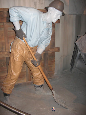
I stopped to help this guy work.


I feel so little next to this.


These two guys also needed my help.


The arch gravity dam is 726.4' high, 1244' crest length, 45' crest width and 660'base width. The volume of concrete is 3.25 million cubic yards. This is a BIG dam.

This is the new bridge under construction across the Colorado River. The Arizona approach to left and Nevada approach on the right. The middle part will be built by the Hoover Dam Authority (if I remember correctly.) Presently the only way in this area to cross the river is over the dam, but semi trucks are not permitted.

This is a scale model of Hoover Dam. This shows the new road which is much higher. To the right is Lake Mead, America's largest man-made reservoir with 550 miles of shoreline and maximum depth of 498'.


We went to Las Vegas and drove down the famous strip. If we had been one day later we could have seen Donny and Marie.


It's five o'clock somewhere.
We drove a total of 375 miles today and spent the night in Mesquite, NV on the border next to Arizona. Tomorrow I get to see the Grand Canyon. I am so excited!